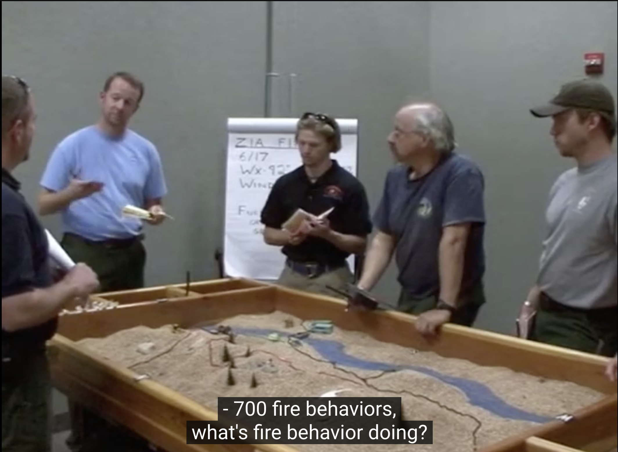
A sand table exercise prepares a team to coordinate, communicate, and make better decisions. Here's an example of a fire crew running a wildfire simulation on a sand table:

I spoke with Ben Mosior this week: he's a pioneer of Wardley Mapping and continues to build new means of exploring this method. Right now he's drawing lessons from the sand table exercise to develop a game-based method for teams to explore, map, and understand their environments.
After we spoke, I watched the sand table exercise video he mentioned (see above). This is a wildfire management training game: it's a simulation, a roleplay, and a well-developed scenario that helps the team test their understanding and prepare for real, future situations.
What I found striking, conceptually and physically, is the gathering function of the table. The team needs to be able to speak about and see the same terrain, and they can do that by all looking at the same thing, speaking about the same features, and working off a shared perspective of reality.
And to resolve the scenario, the map is crucial, but it's only a vehicle for the coordination and the conversation. That scenario, and the conversations and decisions it will contain, also dictates what must be included in the sand table.
In Disposable Models, I argued that our maps and models should be throw-away, purpose-built to reach a decision or coalesce new understanding, and that they should be modifiable and adaptable as the situation changes. I said, "The models are receptacles for critical thinking and conversation" and then went on to miss what the sand table reveals: to make the map or the model work, people actually need to gather around it and talk about it and do something with it.
The map may be a pre-requisite, but to activate it requires time, space, and attention. And so:
How do we shape our maps and models to enable the right kind of discussions and decisions?
It feels like an obvious question — it only clicked for me after I saw the sand table exercise.
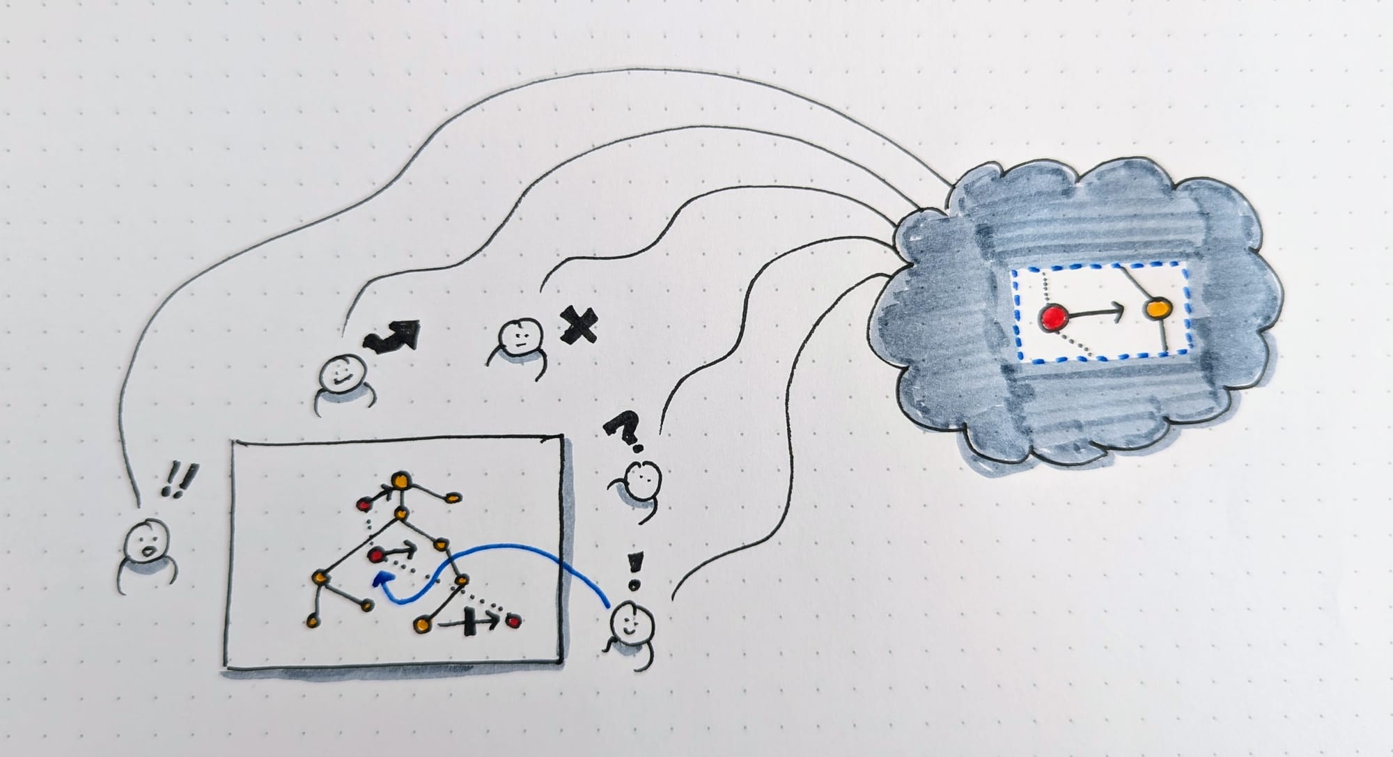
The sand table is the scaffolding for the simulation. A Wardley map is the scaffolding for the strategy cycle. A user journey is the scaffolding for an informed design decision. For any of those things to work well in a team larger than n = 1, that scaffolding must enable the right kind of conversation and constructive decision-making.

There are two acts here.
First is the observation and orientation that build the map, selecting salient features of reality, constrained to the situation at hand. (If it's unchartered territory or a new kind of map, it takes time for the team to see what it says as easily as they "see" what Google Maps shows.)
Second is the collective conversation that leads to deciding and acting: this is what the map supports as scaffolding, and it ought to be the constraint that shapes the final picture of our map or model.
That sand table doesn't contain a lot: it has some basic features, sand of course, a blue stripe, some string, some yarn, and miniature pieces of equipment that represent real-world machines. Nothing irrelevant, it's extremely spare.
The better we get at anticipating the situations, the discussions, and the decisions to be made, the better we'll be at making our maps and models constructive, productive, and fit-for-purpose.
Other items of note:
- Lisa Koeman published another great visual exploration of interviewing, this time looking at the shape of our up-front interview plans and the different kinds of questions we may intend to ask.
- I'm speaking at Map Camp 24, this year in September. Early bird tickets are still available. My talk title + scope are still firming up, but I'm exploring some of the basic ideas in this update. A warning: you'll likely see more Wardley-map-related thinking in upcoming updates to Loops and Cycles.
This is Loops and Cycles, a weekly mailing list exploring how we work together and make good things. Share it with your team, send it to a friend, or send me your thoughts and questions.


![Sand Tables [LC10]](/content/images/size/w100/2024/06/viewing-visual-things.jpg)
